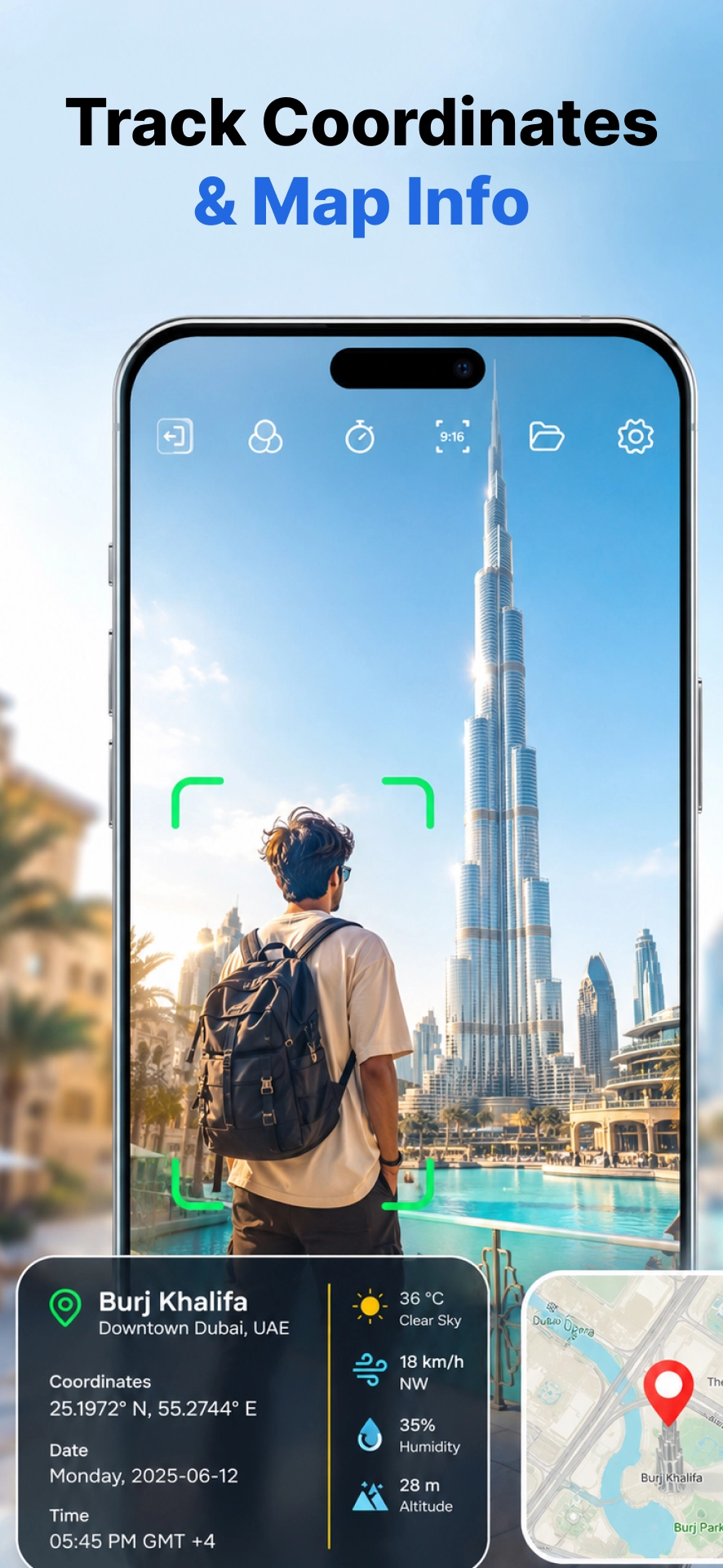
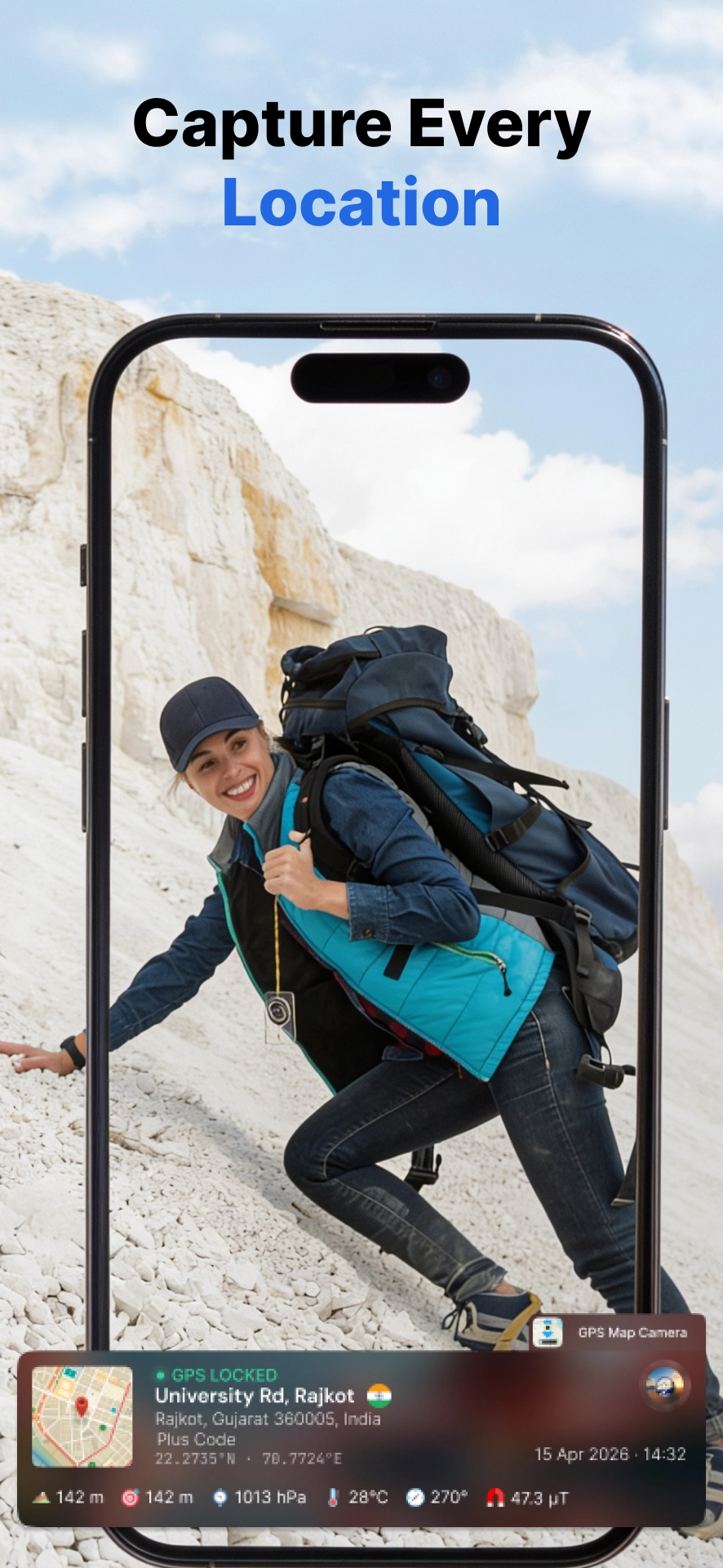
GPS Camera stamps live location, coordinates, weather, map and time onto your photos and videos — automatically. Beautiful enough for travel, precise enough for the field.
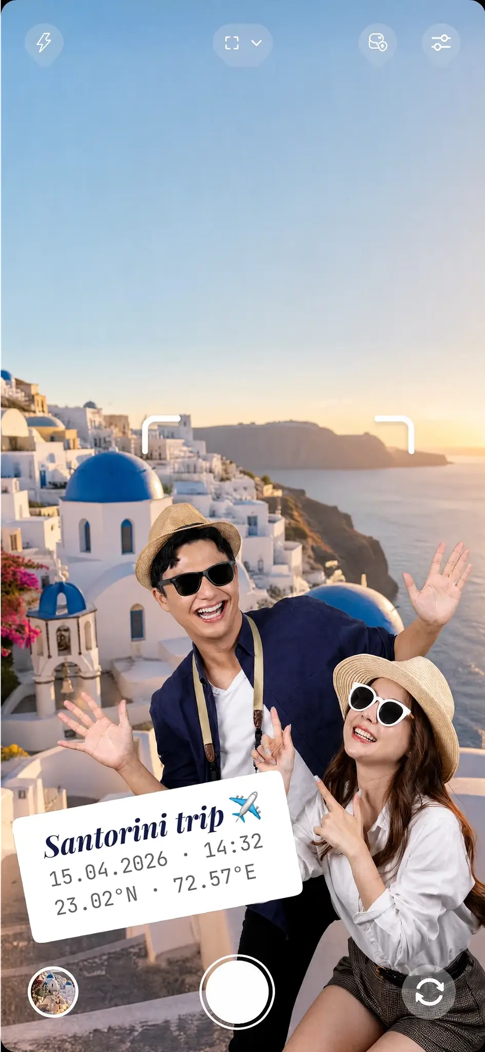
No editing afterwards, no manual notes. The moment you capture, GPS Camera reads your position, the map, the sky and the clock — and lays it onto the frame.
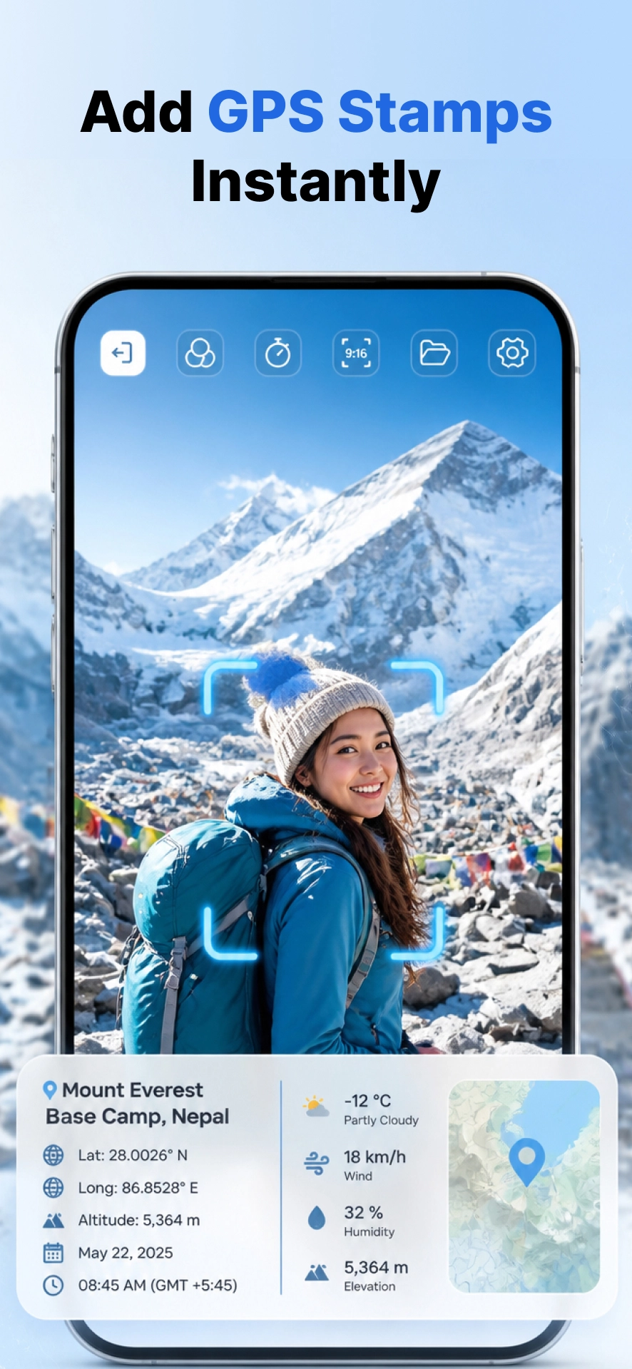
Location, coordinates, altitude, weather and timestamp drop onto your photo automatically — no second app, no extra step.
Read your position the way the field needs it — DMS or decimal, with a Plus Code for the spots that don't have an address.
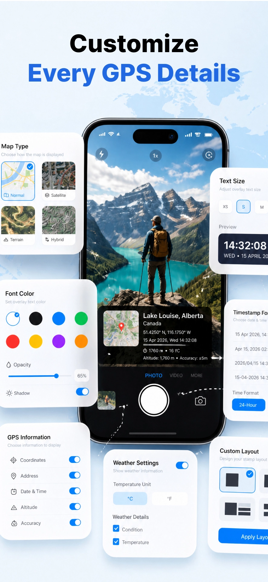
Pick what shows, where it sits and how it reads. Fonts, colors, opacity, shadow, text size and layout are all yours.
Geotagging is the start. GPS Camera is a complete capture tool built to be fast, light and genuinely pleasant to use every day.
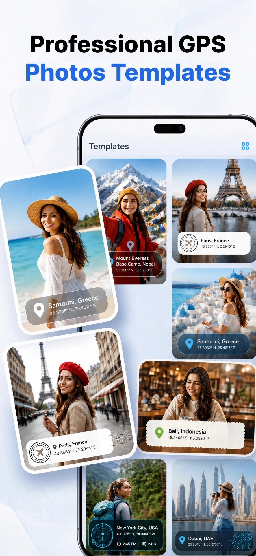
Travel, work, real-estate and more — switch the whole look in one tap.
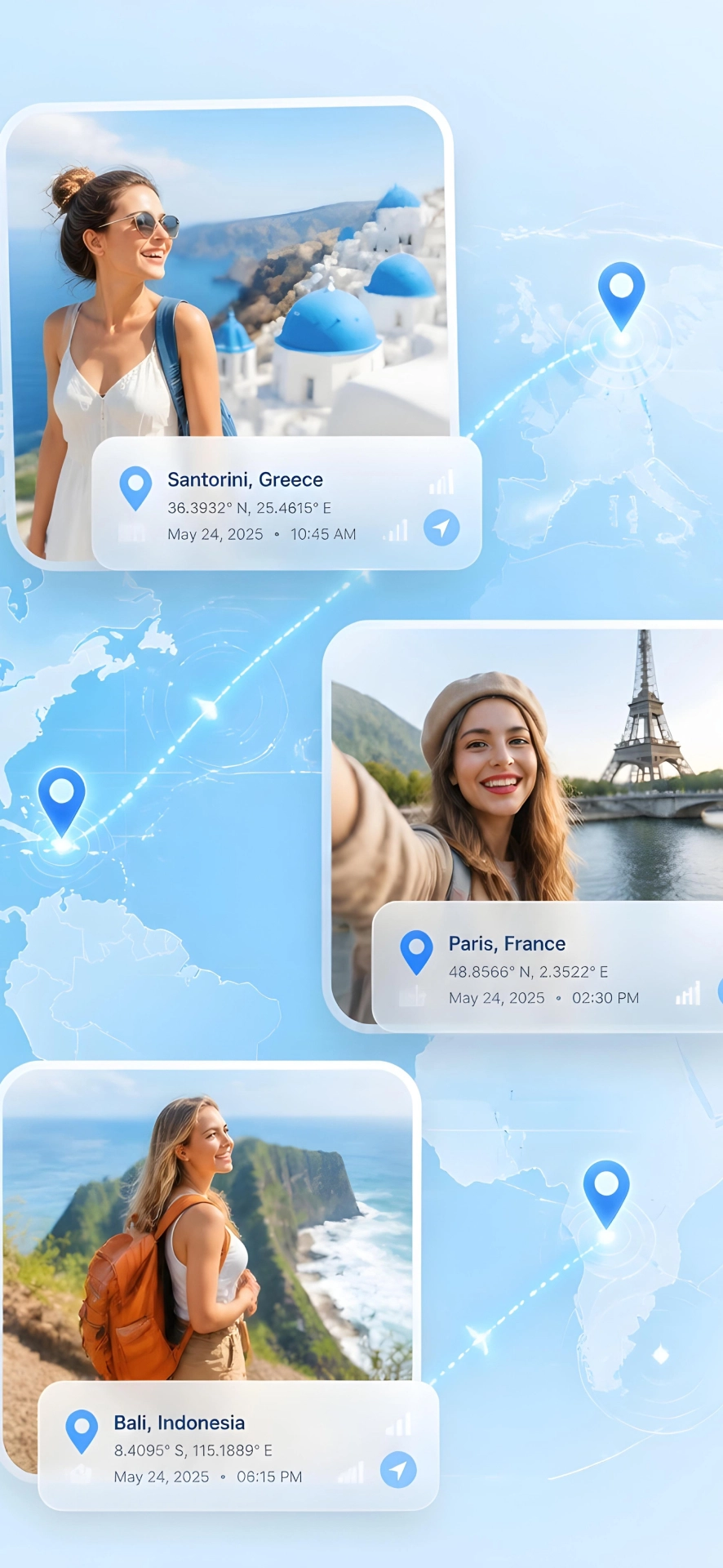
Lat, long, weather, a verified badge and a live map on every photo.
Stamp moving footage too — GPS overlays work on video, not just stills.
Turn a set of stamped site photos into a clean, shareable PDF report.
Browse by date or by project, so field shoots stay organised on their own.
Every photo keeps its complete location record, ready to read or export.
Zoom, brightness, filters, focus and frame size for the shot you want.
Scan codes fast without leaving the app — handy on every job site.
Quick to open, easy to learn, light on storage and easy on the battery.
The advanced template reads the world around you and writes it onto the photo. Toggle any field on or off — keep it minimal, or capture the full picture.
30+ ready-made designs · build your own layout
A look for every reason you're shooting — a clean field stamp for a site visit, a beautiful tag for the trip you'll want to post.
The same stamp that makes a travel photo unforgettable makes a site photo accountable.
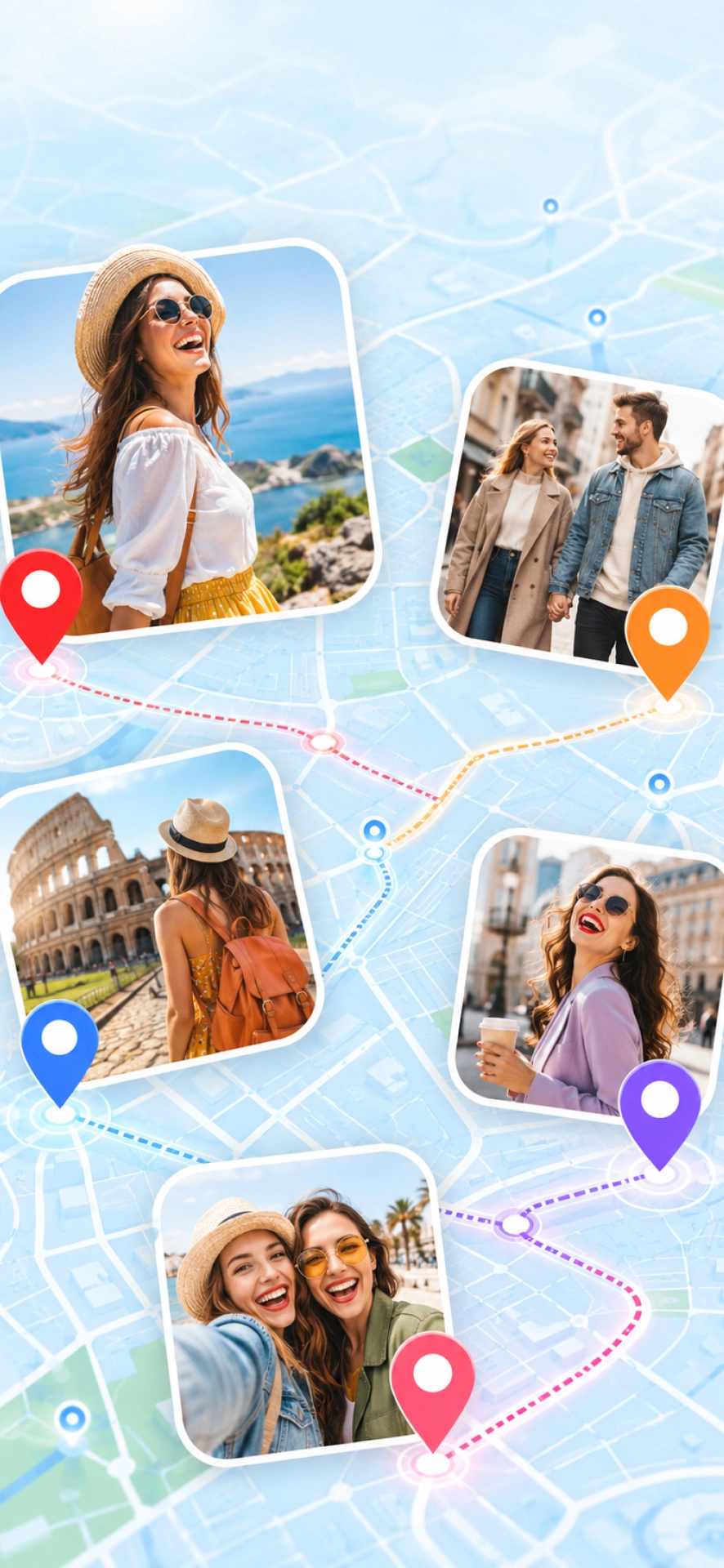
Geo-tag the trip as you go and come home with photos that remember exactly where they were taken.
Stamp site, infrastructure and inspection photos with verifiable location, time and conditions.
Mark destination weddings, meetups and milestones with the place they happened, on the frame.
Use it as a GPS notecam: capture field data on the photo, then export a tidy PDF report.
Document meetings, conferences and offsite work with proof of where and when they took place.
Travel, food, fashion and art creators add location context that makes every post land harder.
Download GPS Camera: Map & Timestamp and start stamping verified location onto every shot — on iPhone and Android.
Free to start · Faster, lighter, and easy to use